We provide data-driven insights and solutions powered by Satellite × AI.
We turn satellite data into actionable insights for forest carbon credits. Our AI-powered platform monitors vast forests in real time, visualizing changes invisible to the human eye.
From land selection to report creation, we provide end-to-end support, helping you generate reliable, high-quality carbon credits and make informed forest management decisions.
CanopyScope
AI-Powered Forest Monitoring for Carbon Credits & Sustainable Land Management
Reduce costly field work with automated satellite insights.
Optimize planting, track biomass, and monitor project performance using advanced AI and continuously updated geospatial data.
01
Understand Your Land
Identify forest types, land-use patterns, and restoration opportunities with detailed land analysis.
02
Maximize Your Carbon Credits
Run advanced simulations for profitable and sustainable project plans that optimize credit generation.
03
Measure Biomass With Confidence
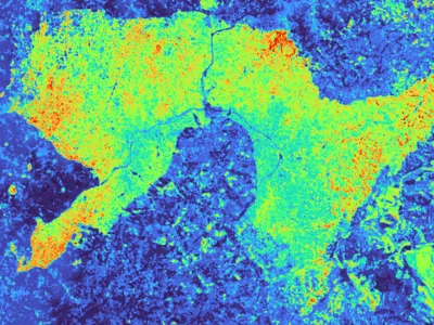
Get accurate Aboveground Biomass (AGB) estimates using our advanced remote sensing technology.
04
Stay Ahead of Risks
Receive near real-time alerts and continuous monitoring to protect your investment and ensure project integrity.
05
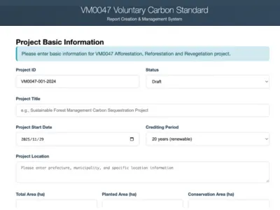
Produce Audit-Ready Reports
Effortlessly export baseline, monitoring, and verification documents formatted for auditors.
06
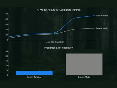
Our Al is tuned to your local data
We train on local vegetation and terrain data to deliver high-precision analysis tailored to your specific site.
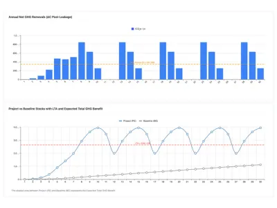
Precision Calibrated With Minimal Local Data
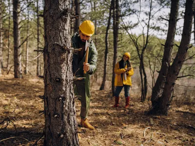
Our proprietary AI model adapts directly to on-ground data and delivers project-grade AGB accuracy using as few as 10 to 15 plots. This approach reduces fieldwork compared to traditional remote sensing methods while maintaining reliable, high quality results.
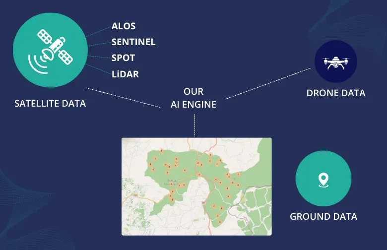
Flexible Data Inputs: Public, Low-Cost, or High-End
Our platform works seamlessly with low-cost public satellites (Sentinel, Landsat), but can instantly upgrade to high-resolution imagery, drone data, or LiDAR where needed.
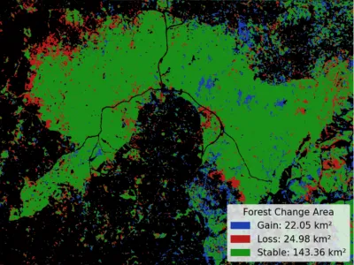
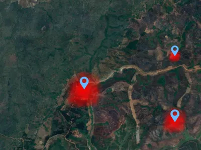
Near Real-Time Monitoring With Actionable Alerts
We analyze fresh satellite scenes weekly, sending alerts for deforestation, illegal logging, fires, and land-use change so issues are contained early.
Our strengths
Demo Video
See CanopyScope in Action.
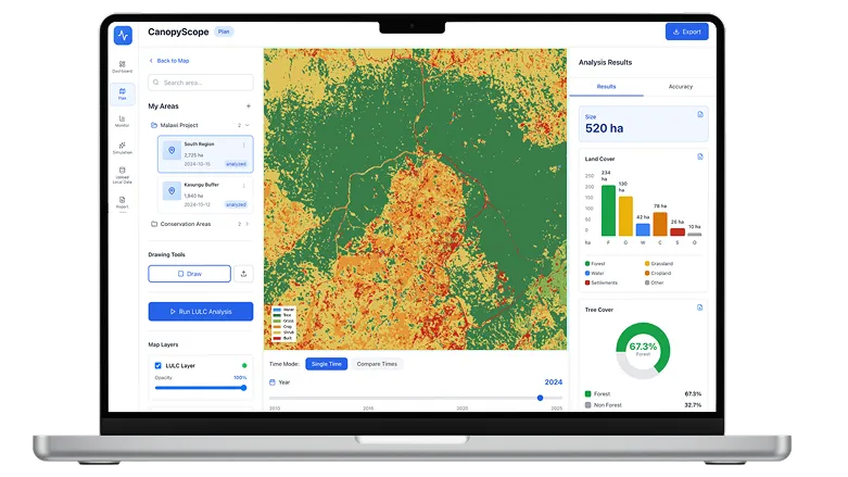
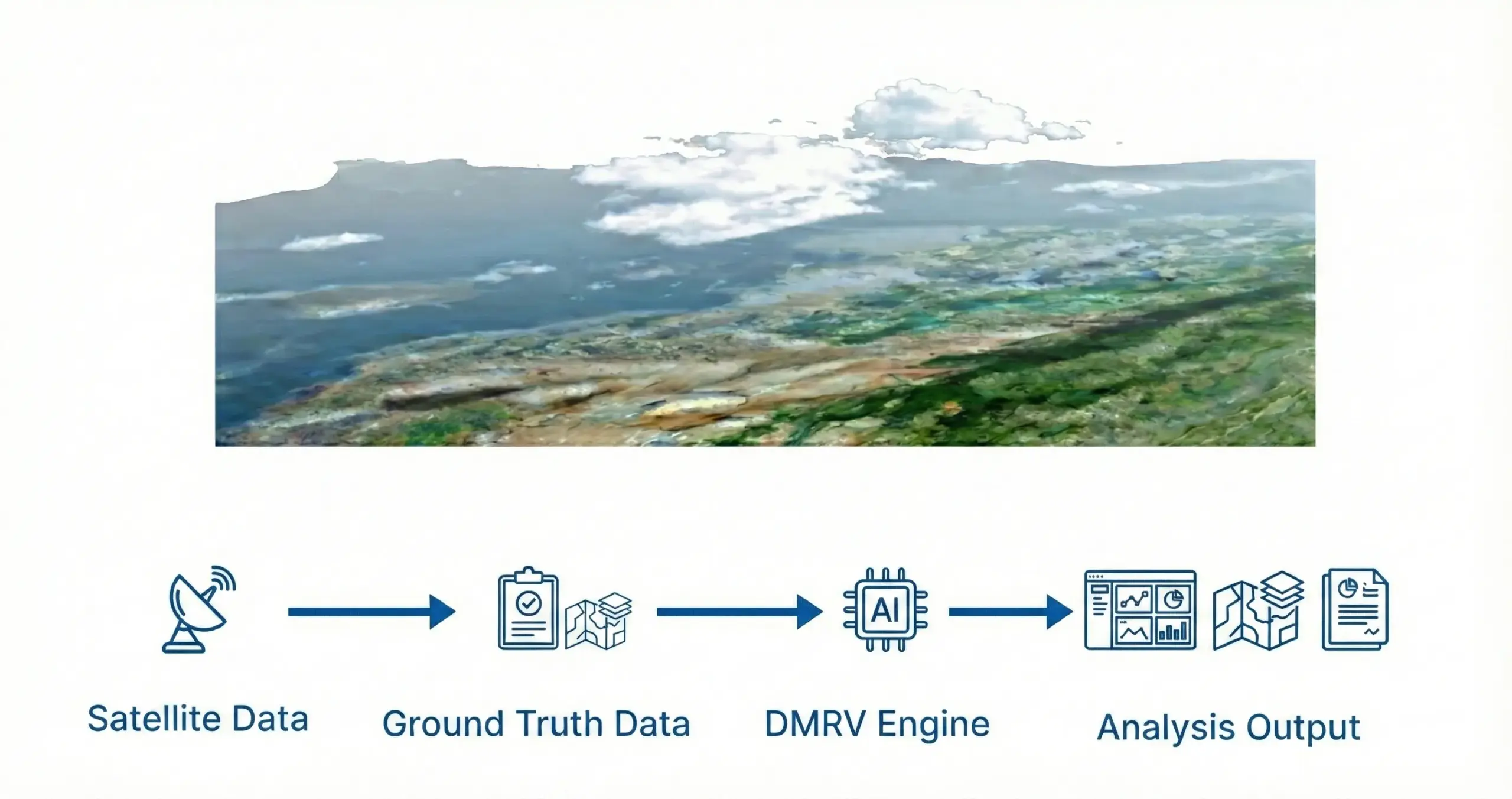
DMRV Engine : How It Works
Our system combines satellite imagery with ground-truth data to generate highly accurate land-cover classification and above-ground biomass estimates which enable reliable, audit-ready insights for carbon and nature-based projects.
Value for stakeholders
Project Owners :
Increase project efficiency and credibility with accurate, automated carbon monitoring.
Investors / Carbon credit buyers :
Reduce investment risk and make data-driven decisions with reliable project performance insights.
Partner With Us
We work with organizations that need scalable environmental intelligence, covering everything from carbon monitoring to land use analytics.
Reach out and let’s talk about how our solutions can help you achieve your goals.